
Authentic Portland: A short zoning timeline
Portland’s Plan envisions an authentic Portland that acknowledges and celebrates its history, even as it evolves. In kicking off ReCode Phase II, we saw an opportunity to engage with the city’s past around land use and zoning, and to use this history as a launching point for the code rewrite work. Based on maps and plans collected from the city’s archives, the following is a quick look at the evolution of the city’s land use code, from its origins to the present.
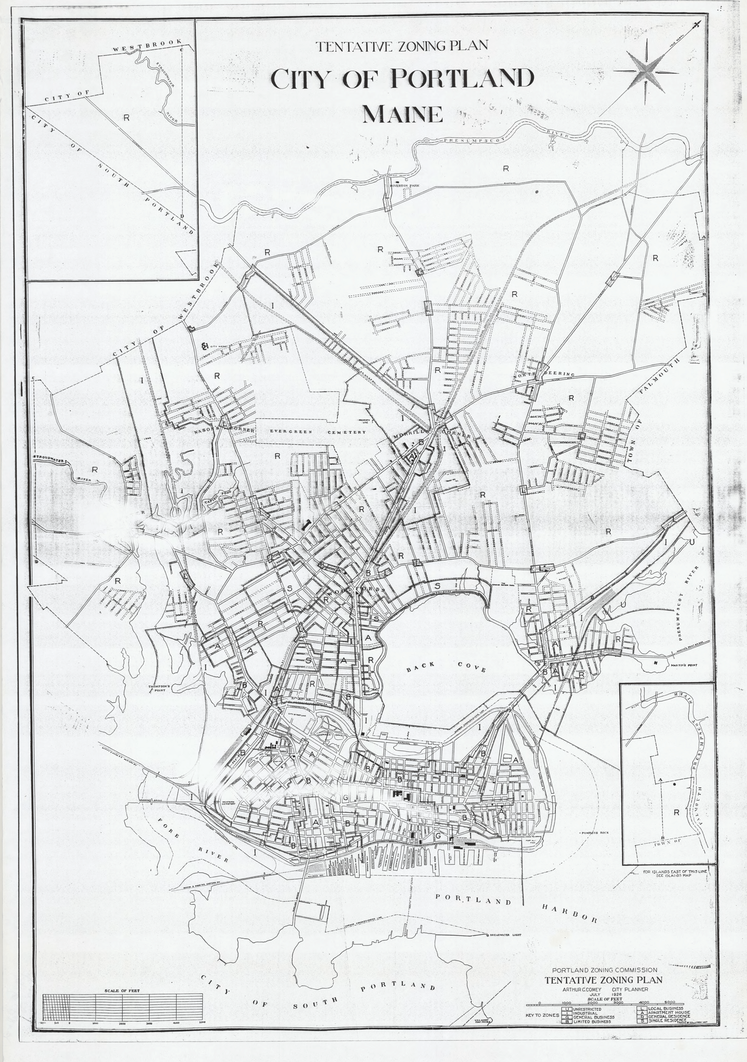
1926
The City's first zoning ordinance is adopted, establishing eight use classifications: industrial, local business, limited business, general business, single residence, general residence, apartment house, and unrestricted.
Tentative Zoning Plan, July 1926

1944-6
The City adopts its first 'comprehensive master plan' under the guidance of the Planning Board in 1944. Substantial revisions to the zoning ordinance and map follow in 1946.
Zoning Map, March 1946

1957-8
Starting in the 1950s, the Planning Board shifts away from 'a comprehensive master plan for the city as a single document' and instead towards 'detail plans' for particular areas or 'specialized land uses,' including a series of urban renewal plans. Based on this work, the City completes a major ordinance rewrite and revisions to the zoning map in 1957-8. This ordinance and the associated map hold, with few major revisions, for the subsequent two decades.
Mainland Zoning Map, drawn March 1958, with amendments through 1975

1970s
Describing the 1957-8 zoning as 'obsolete and outmoded,' the City completes the Land Development Plan of 1974. Based on the plan, a major rewrite of the zoning is drafted in 1979, but stalls. The plan results in a number of incremental changes in the code, including the creation of the waterfront zoning, new industrial zoning, and open space and shoreland zoning.
Mainland Zoning Map, drawn March 1958, with amendments through May 1984

1980s
The City, still working with an ordinance it characterizes as 'rigid and dependent on cookbook formulas for placing a building of a given use on a particular parcel of land,' conducts significant work on a strategic update to the 1974 Land Development Plan. This work, which progresses over the subsequent 15 years, results in area and topic plans related to the waterfront, housing, the islands, downtown, industrial and commercial uses, open space, and historic preservation, among others. Much of this planning results in ordinance and map amendments.
Mainland Zoning Map, drawn March 1958, with amendments through 1990

2000s
Through the 2000s, the city continues its assembled approach to comprehensive planning, developing a ‘broad spectrum of comprehensive plan elements’ as independent, but related documents. These plans, including Green Spaces/Blue Edges, A New Vision for Bayside, and Housing: Sustaining Portland’s Future, among others, lead to incremental work on the land use code and zoning map throughout the early 2000s.
Zoning, February 2002

2017
In 2017, the City returns to the concept of a single, unified comprehensive plan, and adopts Portland's Plan 2030. The plan addresses environmental, economic, transportation, housing, waterfront, open space, and historic resources in the city, and lays the foundation for ReCode, the City’s first large-scale land use code rewrite in over half a century.
Zoning, February 2021