
Connected Portland: Land Use Meets Transportation
The term connected is expressed in many ways in the comprehensive plan, but it manifests perhaps most literally in the fabric of our transportation system. As we begin Phase II of ReCode, we are reflecting on how transportation infrastructure and land use are integrally linked - not only in the way that our historic transportation system left an imprint on our current development patterns, but also in how the type, design, and relationship between current land uses affects how residents and visitors access everything from food to jobs to recreation.

Our transportation roots
Transportation has played a critical role in Portland’s evolution, from its early days as a port to its 19th century roads to the early 20th century, when an active streetcar system served the city’s major corridors, including Congress Street, Commercial Street, Washington Avenue, Forest Avenue, Brighton Avenue, and Allen Avenue. The transportation system has always been both a response to and a driver of regional development patterns, allowing commercial centers to evolve in places like downtown, Woodfords Corner, and Morrills Corner and facilitating the development of neighborhoods around them.

Our system today (and tomorrow)
Today, Greater Portland METRO provides transit service on many of the city’s major corridors to many of these centers and neighborhoods. Recent transportation planning work on the part of both the City and the region’s metropolitan planning agency, PACTS, has focused on strengthening this network, including all of its multi-modal components, as a framework for future growth. For example, Transit Tomorrow, the region’s long-range public transportation plan, recommends improving transit frequency, supporting transit access, and investing in rapid transit along particular high-potential routes.
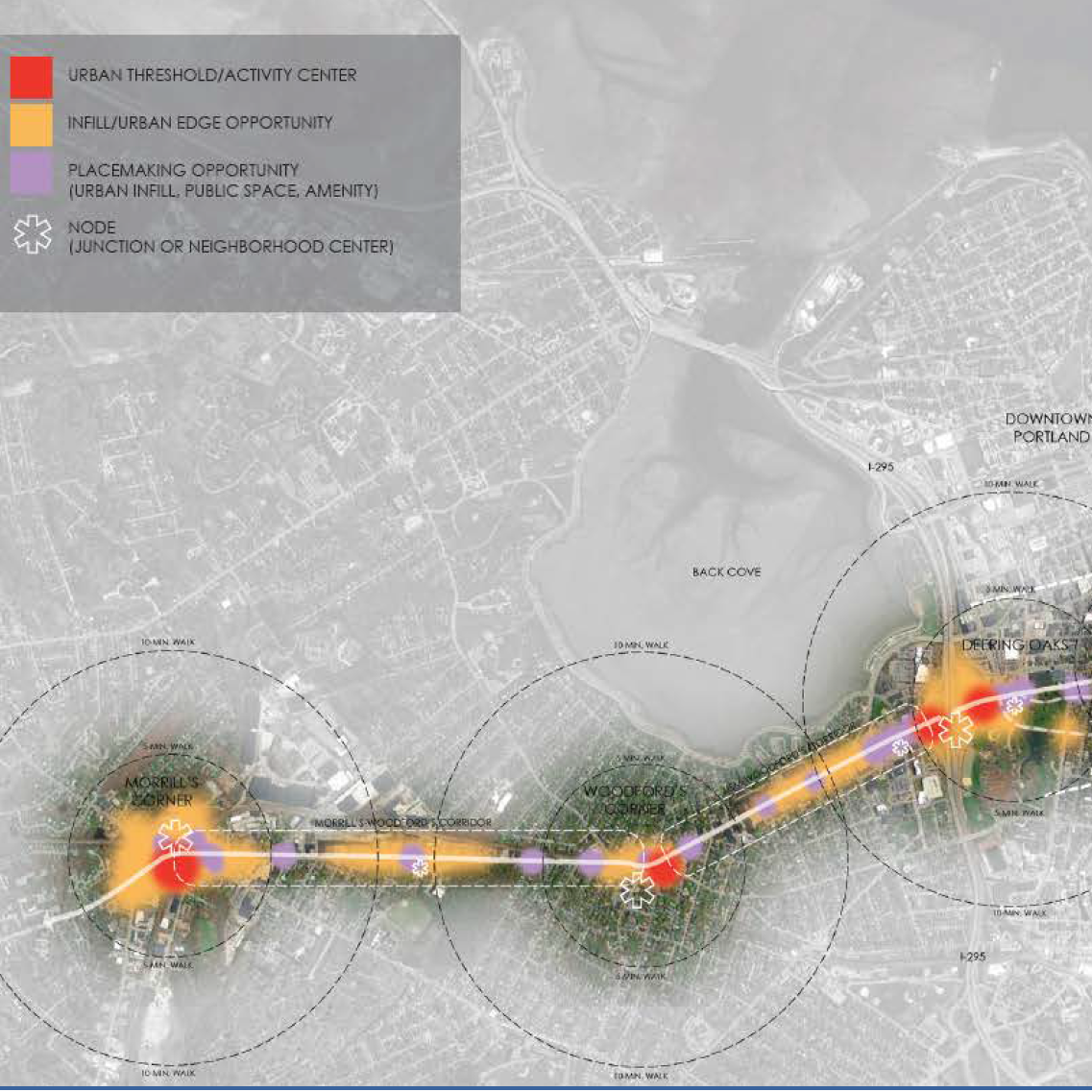
A vision for corridors
At a finer grained scale, planning efforts such as Transforming Forest Avenue and the Portland-South Portland Smart Corridor Study lay the foundation for regional investment in transit, bicycle, and pedestrian facilities along our major corridors. Through the lens of these plans, investments in transportation infrastructure, along with companion land use policy that focuses development near this infrastructure, is central to creating more livable places and more sustainable growth.

Supportive land use
This work is mirrored in the goals of Portland’s Plan. The plan’s nodes and corridors map reflects the regional transportation system, showing particular areas of the city where policy that supports mixed uses, high density housing, and strong urban design can capitalize on transportation assets. (Areas of the city that are not on a node or a corridor will also be evaluated for their capacity to support comprehensive plan goals in ways that integrate well with their surrounding neighborhood contexts.) The vision is that by combining transit-, walking-, and biking-supportive land use policy with the infrastructure to support transportation choice, we can yield real results in terms of access to jobs, resources, and recreation, while also creating dynamic places, improving public health, and supporting the City’s emissions reduction goals.

Questions for the land use code
So what transportation-related questions will we ask of the code during Phase II of ReCode? At a basic level, how can we make sure that our land use policy relates to our transportation investments in a way that achieves the region’s goals? How does land use policy support density around nodes and corridors? Does the code successfully incentivize the mixture of uses and urban form that make streets walkable and transit corridors thrive? How are we supporting transportation choice through urban design? Answering these questions will be critical as we plan for a future of mutually reinforcing transportation and land use investments. This, of course, is key to creating a connected Portland.